Implementing the USLE to Model Soil Erosion in Indonesia.
- Completed In: 2021
- Context: GIS Practice week for the Masters Program.
- Tools: ArcGIS Pro, QGIS, Python
Introduction & Objectives
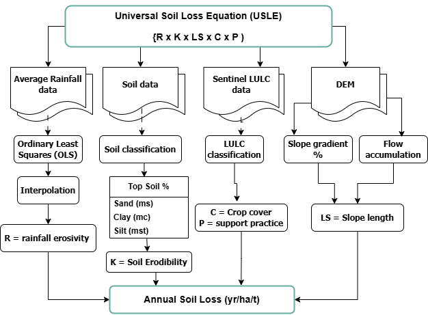
This project employed the Universal Soil Loss Equation (USLE) to model soil erosion in the Cibodas Biosphere Reserve, West Java, Indonesia. The study analyzed the impact of rainfall, terrain, and land use on soil degradation, focusing on the region's diverse slopes and elevation-dependent rainfall patterns. The model gives an estimate of the total amount of soil loss resulting from sheet or rill erosion per hectare per year. By integrating environmental and anthropogenic factors, the project identified areas with high potential and actual soil loss, providing insights into sustainable land management practices in erosion-prone regions.
Objectives
- Calculate the rainfall factor (R-factor) using the Ordinary Least Squares (OLS)
- Derive the topographic factor (LS-factor) from terrain data.
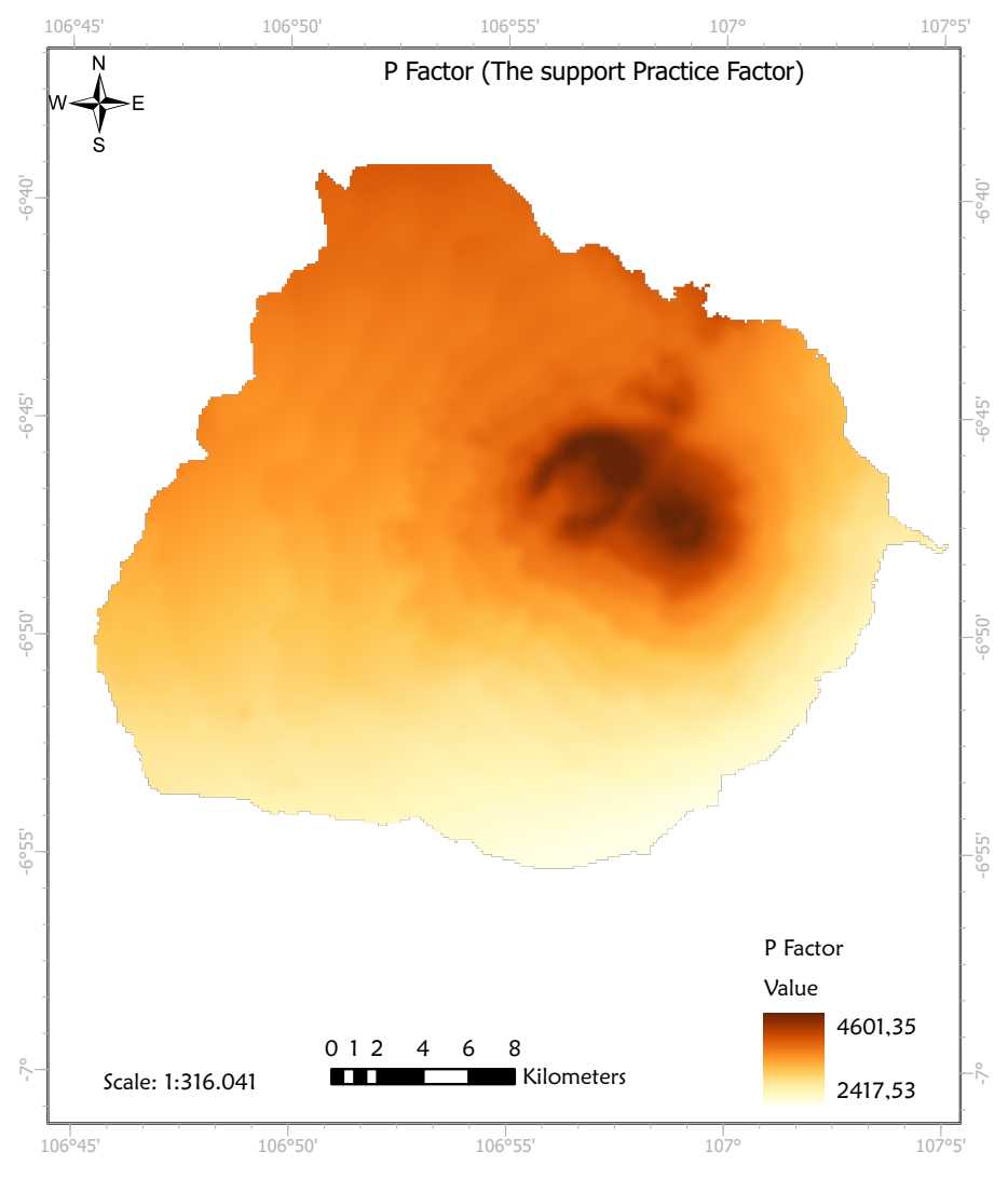
- Develop attribute maps for soil erodibility (K-factor) and management practices (C and P factors)
- Estimate potential soil loss across different land uses.
- Quantify actual soil loss for various land uses.
Methodology
To understand the distribution and accessibility of green free spaces and their significance to happiness in suburbia, the following methodology was adopted,
- R-Factor (Rainfall Erosivity): Rainfall erosivity index was calculated with a regression analysis using the Ordinary Least Squares (OLS) tool to measure the intensity of rainfall and its runoff potential and its dependence on elevation.
- K-Factor (Soil Erodibility): The K-factor assesses soil susceptibility to erosion, based on soil characteristics. Soil data were joined with K-factor values, and the resulting polygons were converted to raster.
- SL-Factor (Topographic Factor): The SL-factor evaluates the influence of slope length and steepness on erosion. Contour lines were converted to raster, and slope was generated, followed by low-pass filtering to reduce noise.
- C and P Factors (Crop and Management Factors): C and P factors reflect land-use impacts on soil erosion. Provided CP values were joined with land-use data and converted to raster for analysis.
Results & Discussion
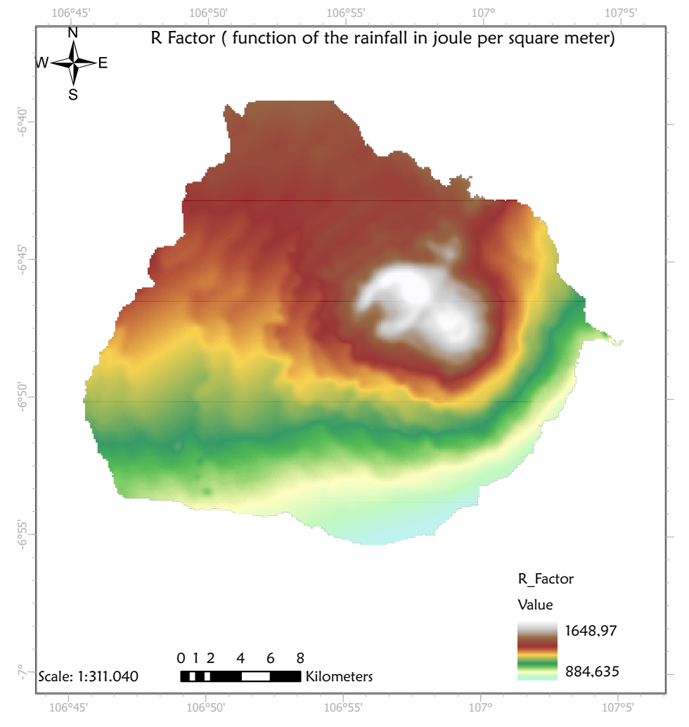
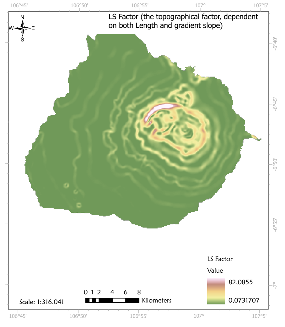
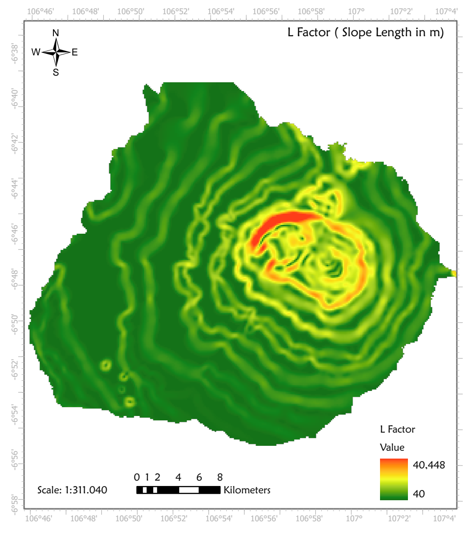
Annual rainfall per year was calculated as: P_rainfall = - 365,875.5281 – 2.026832X + 0.041915Y + 0.0674449Z. After getting P, the R-factor was calculated using the formula: R = 38.5 + 0.35P. The slope length (L) of Cibodas Biosphere Reserve was calculated from the slope (S) value using formula: L = 0.4S + 40. The SL factor was then calaculated using the calculated L value. The formula used for calculating the LS value was: SL = (L/22.13)m(65.41 sin2 s + 4.56 sin s + 0.065).
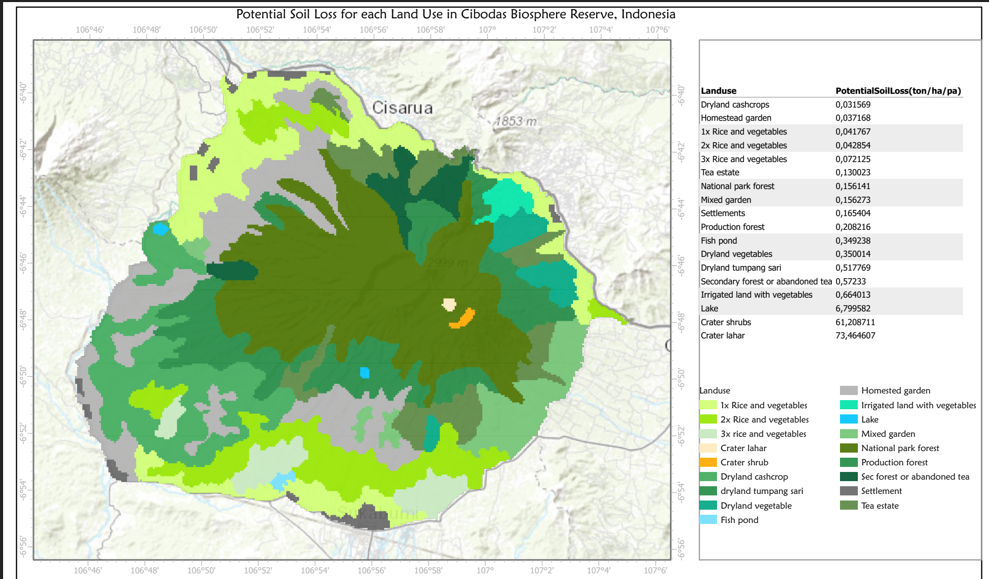
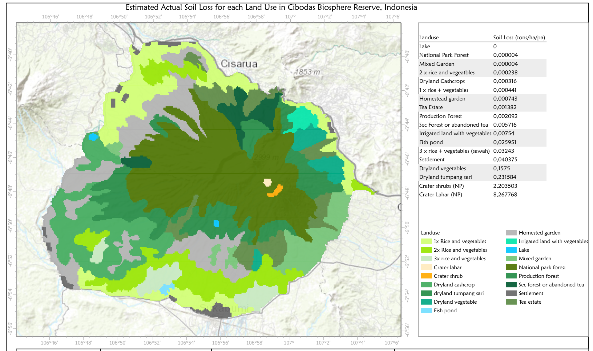
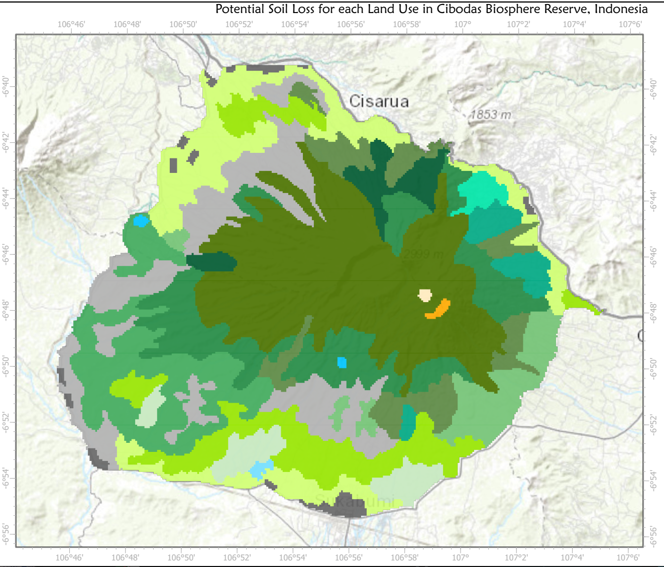
The modeling revealed that crater land zones exhibit the highest potential soil loss, exceeding 61 tonnes per hectare annually, while fish ponds and 3x rice and vegetation zones had the lowest losses. Actual soil loss was also highest in crater zones, with 82 and 22 tonnes per hectare annually for Lahar and Shrub, respectively. Conversely, mixed gardens and national park forests experienced minimal soil loss, below 1 kg per hectare annually. The elevated soil loss in crater zones is likely attributable to high elevation, leading to increased rainfall and runoff. Mitigation measures are recommended to address the significant soil erosion in these areas.